
Distance: 3 km approx. 1 hour
Ascent: 47 m
Difficulty: Easy

An exploration of Wray Cleeve, the ancient woodland on the hillside opposite us. The basic route follows the obvious path along the bottom of the wood and then returns on the Wray Valley Trail. There are options to climb to the top of the wood to explore the crags and get a view across to Haytor. Great for an afternoon or evening stroll to stretch the legs after a long drive. The start can be a little muddy.
Distance: 9 km approx. 2:30 hours
Ascent: 80 m
Difficulty: Easy
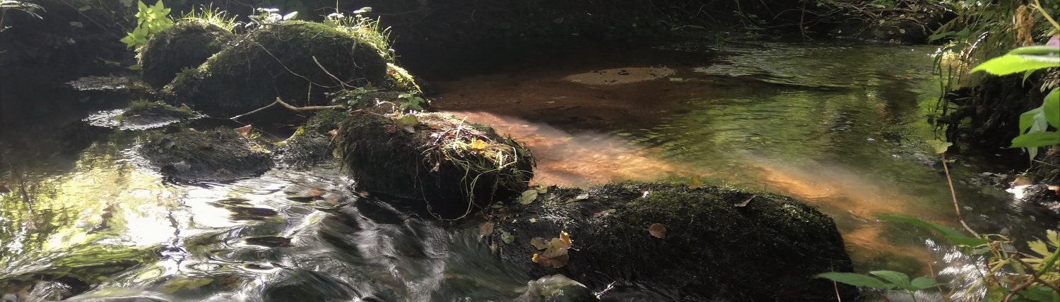
 A pleasant stroll down the Wray Valley Trail to explore Lustleigh. Optional extension to see Kelly Mine, which is normally open on Wednesday and Sunday (<1 km each way). The route takes in the War Memorial, the Community Orchard with May Queen Rock, Wrayland hamlet, the Wray Brook and returns to the village green with the pub, church, tea shop, village shop and art gallery.
Distance: 9 km approx. 2:30 hours
Ascent: 70 m
Difficulty: Easy
 A pleasant stroll up the Wray Valley Trail to explore Moretonhampstead. There is a town trail that can be purchased from the Tourist Information Office and we have a copy you can borrow. Find out about the Sparrowhawk, the connection to WH Smith, the Sentry and the Almshouses.
Distance: 9 km approx. 3 hours
Ascent: 233 m
Difficulty: Moderate

On a clear day Blackingstone Rock gives magnificent views of the high moor. From Haytor to Hound Tor (East Dartmoor), Hangingstone Hill right round to Yes Tor and High Willhays.
A flight of very steep steps cut in the granite by the Victorians lead to the summit where several rock basins have formed in the flat surface.
Legend has it that King Arthur and the Devil were having an argument. King Arthur took his stand on the hill where the Blackingstone now stands and the Devil on the hill where Hel Tor is today. It was decided that the best way to settle this dispute was by hurling a mighty quoit at each other. As the quoits hit the ground they immediately turned to stone forming Blackingstone Rock and Hel Tor.
Distance: 11.5 km approx. 4 hours
Ascent: 249 m
Difficulty: Moderate

A beautiful walk through Lustleigh Cleave (Devon word for wooded river valley). The walk can be done in either direction but we prefer to head north up the Wray Valley Trail to Wray Barton. That way we get the steep climb up the Manaton road out of the way early on, and have a stop off in Lustleigh for refreshments to look forward to!
The route can also be cycled – but it has steep and rough tracks!
Distance: 7.5 km approx. 2 hours
Ascent: 150 m
Difficulty: Moderate
 A walk across undulating farmland between Moretonhampstead and North Bovey following the Dartmoor Way. Refreshments available at the Ring of Bells in North Bovey and in Moretonhampstead. Lovely picnic spot beside the river in North Bovey.
Distance: 6 km approx. 1:45 hours
Ascent: 200 m
Difficulty: Easy to Moderate

A short walk from Lustleigh to the scenic Hisley Bridge at the bottom end of Lustleigh Cleave. There is a steep climb from the river to Heavens Gate, but otherwise the walk is easy going. The walk can be shortened by 1km and the climb reduced by returning via Rudge as shown. Alternative start point at Pullabrook car park near Drakeford Bridge. Find out more about the Bovey Valley Woods.
Distance: 11 km approx. 3:15 hours
Ascent: 230 m
Difficulty: Moderate
 The route is shown starting at the end of the Wray Valley Trail in Lustleigh but it can of course be made longer by starting here at Wray Valley or much shorter by starting at the Reservoirs Car Park. Do not attempt to walk down the A382 to start the walk at Wray Barton as this is unsafe.
The ascent and descent up through the woods from the A382 to and from the reservoirs is very steep and can be slippery if muddy.
On Wednesdays and Sundays it is usually possible to take a look around Kelly Mine.
Distance: 6.4 km approx. 2 hours
Ascent: 200 m
Difficulty: Easy to Moderate

A lovely walk through shady woods beside the River Teign in the steep sided Teign Valley. The start point in the Hillfort Car Park is the closest to us and avoids a long drive round to Fingle Bridge.
Distance: 12.8 km approx. 4:00 hours
Ascent: 338 m
Difficulty: Moderate
 An extension to the Teign Valley to Fingle Bridge walk. There is a steep cliimb up from Fingle Bridge and the high level path is quite narrow. It is possible to visit the impressive Castle Drogo (National Trust) if you time.
The walk can be started from Fingle Bridge or Castle Drogo. The car park at Fingle Bridge is the other side of the narrow bridge – not on the road leading down to it. The car park at Castle Drogo is owned by the National Trust.
Distance: 8.2 km approx. 2:15 hours
Ascent: 240 m
Difficulty: Moderate

After you’ve climbed Haytor why not go for a longer walk. Imagine this part of the moor teaming with quarry workers and horse drawn trams. Visit the enchanting Haytor quarry and follow the granite tramway to Holwell Quarry. See if you can find the Beehive Hut where the quarry workers took shelter from the weather. Cross the Becka Brook and climb the other side of the valley to Hound Tor and the medieval village. In May the bluebells on Holwell Lawn are a spectacular sight and give off a wonderful heady scent. At Hound Tor you may be lucky and be able to get a calorie laden snack from Cakes on Tor before heading back to the start.